Rewriting the rules for water use in the High Plains
Local approach to water conservation gaining momentum
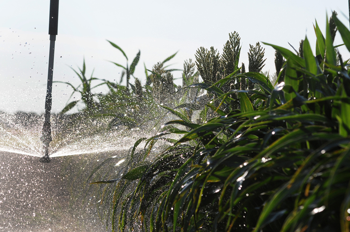
The Ogallala Aquifer is a vital water source for agriculture and drinking across the High Plains. Historical agricultural practices—combined with slow regeneration—are rapidly depleting groundwater across the region.
Some High Plains states are trying to slow down groundwater depletion by reducing water use across the Ogallala. One such program, named Local Enhanced Management Areas, or LEMAs, is catching the eye of water managers across the region for its uniquely local approach to water conservation.
While LEMAs have shown promise in stabilizing water use in some Kansas regions, broader adoption across the High Plains faces legal, cultural, and climatic challenges, highlighting the need for adaptable, community-driven water policies.
Brett Oelke still remembers the first sign of trouble. At the turn of the 21st century, Oelke—a fifth-generation farmer in Hoxie, KS—was finishing out high school while living on his family’s farm. For decades, the Oelke farm had relied on groundwater irrigation to water its crops. But now, the family kept having to replace the nozzles on its irrigation system, a sign that its wells were losing water capacity.
The Oelke family wasn’t the only one having trouble. “Everyone knew the water table was dropping because they had to continuously re-nozzle their sprinklers,” Oelke recalls.
Hoxie is one of many towns west of the 100th meridian—the line that divides North America’s humid east and arid west—that relies almost entirely on groundwater to survive. Many of these communities draw on water stored in the Ogallala, a major underground reservoir that makes up most of the High Plains aquifer. Today, the Ogallala is the primary source of drinking water for around 2.3 million people across eight states in the central U.S. It’s also the lifeblood of agriculture in the High Plains and supplies nearly 30% of all irrigated water in the United States.
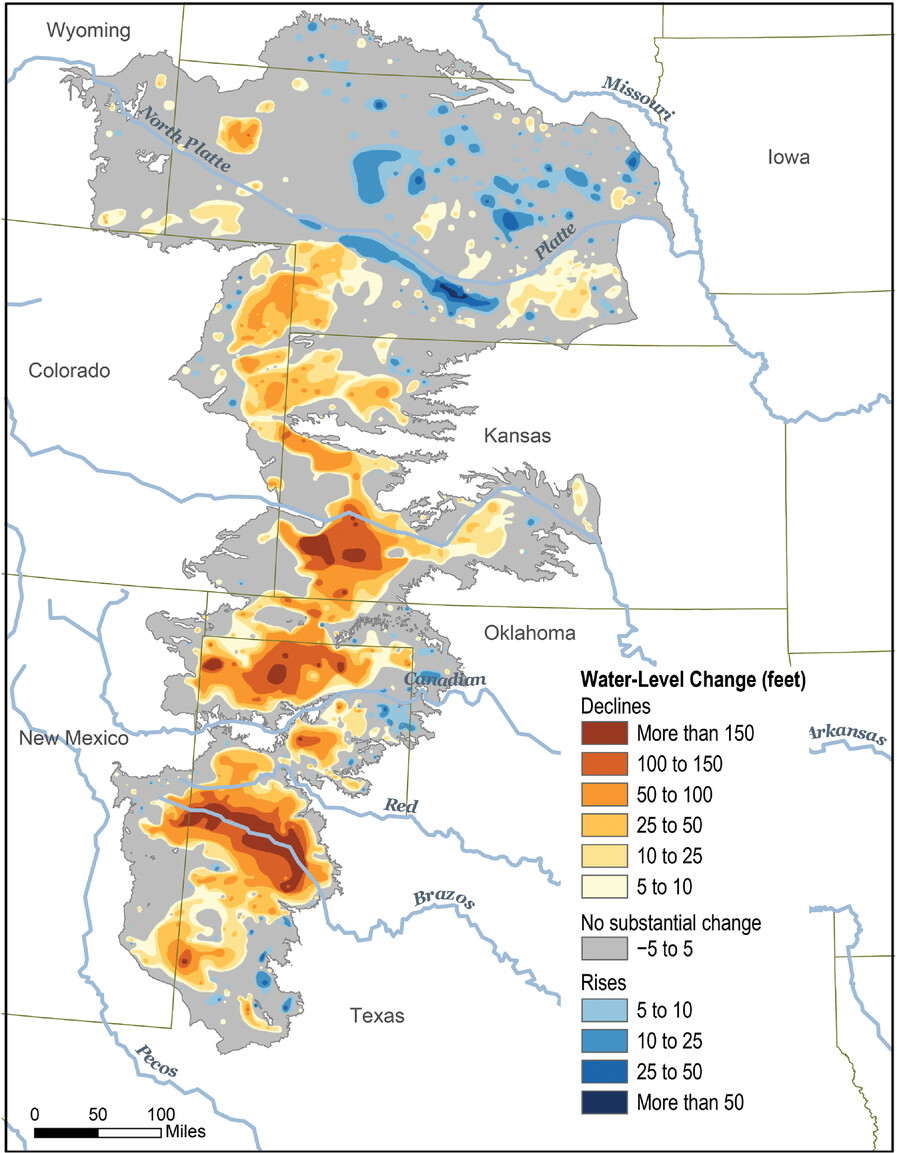
But the Ogallala’s reserves aren’t endless. Historical agricultural practices—combined with the slow regeneration of the High Plains aquifer—are rapidly depleting groundwater across the region. Agriculture is a multi-billion-dollar cornerstone industry for many states in the High Plains. Now, rural communities like Hoxie found themselves caught in a catch-22: dependent on a groundwater supply whose very existence they threaten.
In a bid to deal with the situation, some High Plains states are trying to slow down groundwater depletion by reducing water use across the Ogallala. One such program, named Local Enhanced Management Areas, or LEMAs, is catching the eye of water managers across the region for its uniquely local approach to water conservation. Jean Steiner, an ASA and SSSA Fellow, adjunct professor at Kansas State University, and a member of the Kansas Water Authority, delivered a presentation describing the creation and outcome of Kansas’s LEMA programs at the CANVAS 2024 meeting in San Antonio, TX.
Unlike state-run programs, LEMAs are created with farmers—and often at their request—to protect water as a resource critical to their livelihoods. In 2013, Oelke was part of the first LEMA implemented in Kansas. The project, dubbed Sheridan-6, was so successful that it has since spurred the creation of three other LEMAs across the state.
Now, other areas are looking at LEMAs with an eye to developing similar programs. But it’s not clear whether LEMA’s will work across the High Plain’s complex tableaux of water laws, geology, and communities.
However, Oelke, for one, is sold.
“It’s had an extremely positive impact,” he says. “I really wish we could have just done it about 20 years sooner.”
Ancient water and modern farming
Water in the western United States has been a contentious issue for centuries. Some parts of the country west of the 100th meridian receive 20 inches of less rain per year and surface water sources are few and far between. Even rivers like the Arkansas that historically ran through the region are now running dry due to agricultural use, droughts, and climate change.
“[The LEMA] has had an extremely positive impact. I really wish we could have just done it about 20 years sooner.”
For many people in the region, drinking water is something that comes from the ground. The High Plains aquifer is one of the largest groundwater reservoirs in the world and is the foundation for life and agriculture west of the meridian. One of its main components—the Ogallala aquifer—draws its name from a vast geological formation that runs through parts of Wyoming, Colorado, New Mexico, Texas, Oklahoma, Nebraska, Kansas, and South Dakota.
The Ogallala first started forming around 16 to 12 million years ago when ancient rivers carried sediment off the Rocky Mountains and into the surrounding plains. When these rivers dried up, they left behind a hodgepodge of sedimentary deposits. Then during the last glacial period, which peaked around 26,000 to 20,000 years ago, water started to seep into the formation’s porous sandstone and mudstone. Today, almost all water in the Ogallala dates to the Ice Age.
Almost no one had access to the Ogallala water for millennia. Then settlers started moving out West in the late 1800s. Scholars at the time popularized the idea that “rainfall follows the plow”—a now defunct theory that cultivation would increase rainfall in the western United States. Farmers and ranchers trying to work this arid landscape drilled wells into the High Plains aquifer and Ogallala just to get by.
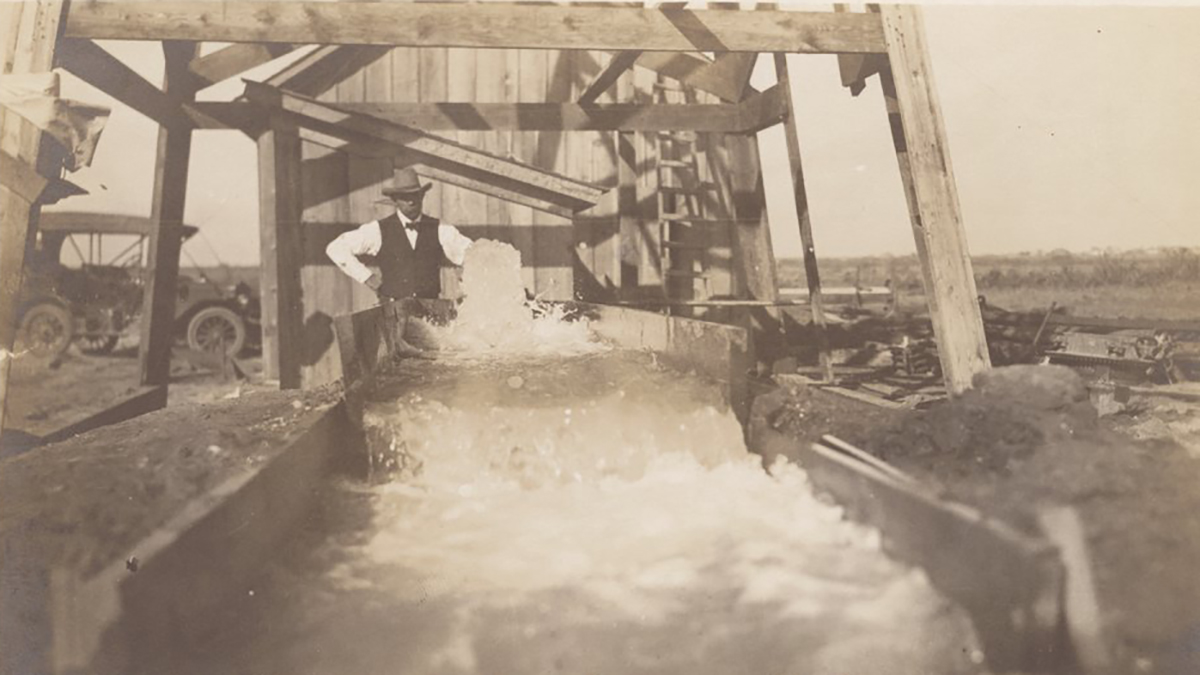
Agricultural demand and new drilling technologies after World War II spurred states to sponsor water rights for irrigation. By 1977, the number of wells drawing water from the High Plains aquifer peaked at around 177,000. To this day, almost all of these wells are used to support irrigated agriculture in the High Plains region.
When the well runs dry
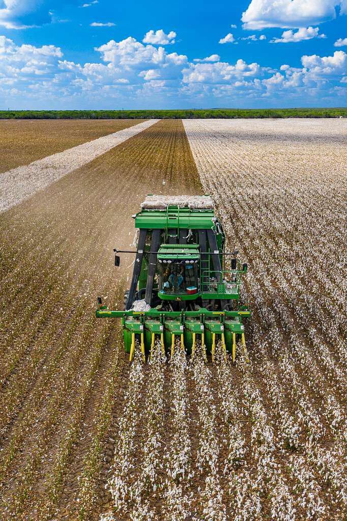
It didn’t take long for people to notice that they didn’t have an endless supply of groundwater. The Ogallala varies widely in depth, up to 460 ft deep in some regions and just 10 ft deep in others. Areas with shallower reservoirs that used groundwater for irrigation soon ran dry.
This is because the High Plains aquifer takes a long time to refill, says Jay Kalbas, the Kansas state geologist and director of the Kansas Geological Survey based in Lawrence. Aquifers in the High Plains are mostly filled with fossil water dating back to the Ice Age. It takes decades for a drop of water on the surface—mainly rainwater—to seep into the Ogallala formation. Since at least the mid-20th century, people in the High Plains region have been sucking up water from the High Plains aquifer faster than it can be replenished.
One PNAS study from 2013 estimated that it could take between 500 and 1,300 years to fully replenish a depleted Ogallala aquifer.
This is a major problem for places like Kansas. Around 19% of all U.S. corn, wheat, cotton, and cattle are produced in the High Plains region. Agriculture is a $5 billion industry for the state of Kansas, and much of the money is generated in countries west of the 100th meridian.
Farming and ranching also represent a way of life for many communities out West. “Groundwater is the only available water” for many of these rural areas, Kalbas says. “If that water goes away, then you have no town.”
All of this was on the minds of state officials when they became aware of the “shocking magnitude of depletion” across the High Plains aquifer during the late 1960s, Steiner says. In 1972, the Kansas Legislature passed the Kansas Groundwater Management Act, which established several high-priority zones across western Kansas for water conservation. The state soon put in place state-sponsored water conservation programs called Intensive Groundwater Use Control Areas (IGUCAs). However, these measures were deeply unpopular among farming communities and faced resistance from constituents.
The state has “tried a whole host of things, and nothing has really stuck to the wall,” says Shannon Kenyon, director of Groundwater Management District 4, based in Colby, KS. Something had to change.
A new kind of water conservation program
There is one simple way to ensure that the High Plains aquifer doesn’t run dry. And that’s by using less water for irrigation.
In the early 2000s, the Kansas Water Authority told the directors of Kansas’s five groundwater management districts that they needed to identify the areas of highest concern within their districts. One way to work this out was by using a map originally created by the Kansas Geological Survey in the 1990s (this map is now updated annually). By comparing water tables to historical levels, state geologists were able to show that some parts of Kansas had already used up to 60% of their groundwater supplies. Those areas needed a plan to curb water use.
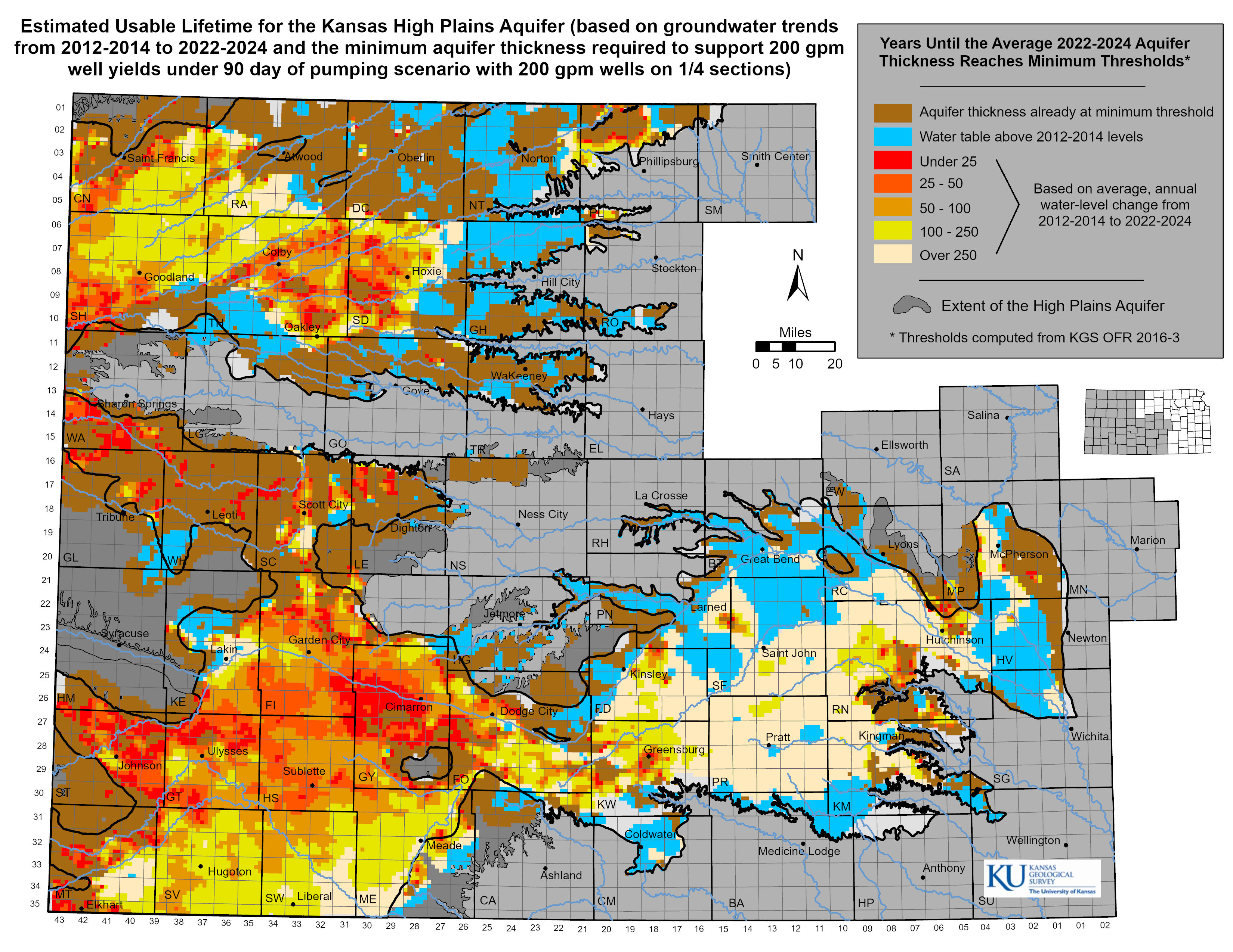
Groundwater Management 4—located in northwestern Kansas—identified six areas of highest concern. The director at the time held public meetings in each area to explain the scale of the problem and what needed to be done. These conversations didn’t always go well. “Water was still really taboo to talk about,” Kenyon says. “Most people at these meetings would say, ‘Leave us alone! We don’t want to talk about it.”
There was one exception. The citizens of the sixth zone—dubbed Sheridan-6—were highly concerned about groundwater loss in their area. Among their number was Oelke, then a recent college graduate running the farm with his father. Oelke started meeting with other producers in the area to talk about how to solve the water problem. But they weren’t thrilled with the options available to them, especially the idea of a state-run IGUCA.
“We wanted something with a little bit more flexibility,” Oelke recalls. Ideally, they’d want a water conservation program that they could have more control over. However, there was no legal structure to create such a program.
So, Oelke and other producers worked with lobbyists to petition the Kansas legislature to create a new, more flexible kind of water program. In 2012, the state passed an amendment to the Groundwater Management District Act that allowed individual districts to create their own water conservation management plans. This allowed Groundwater Management District 4 to work with producers in Sheridan-6 to come up with a new kind of plan.
Sheridan-6 takes off
The result was the Sheridan-6 LEMA, which covered 99 square miles and set the ambitious goal of cutting water use by 20% compared with historical numbers, down to 55 inches per acre over five years.
Here is how it works. Water rights holders in Kansas are usually granted an annual allotment of water. Farmers and ranchers must specify exactly what they intend to use that water for—which fields, pastures, or feeding lots. But under the LEMA, Oelke and other farmers were granted five years’ worth of water that they could distribute around their property at their discretion, so long as they met the water reduction goals. Unlike IGUCAs, which are run indefinitely by the state of Kansas, the locally elected Groundwater Management Board of Directors would later vote on whether they wanted to renew the program at the end of the five-year pilot.
The Sheridan-6 LEMA went into effect on Jan. 1, 2013. It marked an immediate “paradigm shift” in the mentality of farmers within the Sheridan-6 pilot, Oelke says. Before the LEMA, no one talked about water. But it was now a frequent topic of conversation. Neighbors compared how much water they were using to irrigate their fields. For the first time, “people were actually managing that valuable resource more in-depth than they had been,” Oelke says.
The mental shift seemed to work. By 2018, a study examining the results of the Sheridan-6 LEMA found that farmers had outperformed their goal and were using around 23% less water compared with surrounding control areas. There were also surprising economic benefits to the LEMA. Almost all producers saw a drop in crop yield. Yet corn producers saw a 4.3% rise in cash flow compared with producers outside the LEMA. Sorghum growers benefited even more—with a 59.9% increase in cash flow. Soybean producers, on the other hand, lost 12.4% cash flow during the LEMA years.
Even with soybeans, the trend was clear: farmers could find ways to mitigate the economic impact of water reduction. A similar economic trend was reported for the Wet Walnut Creek IGUCA, first instituted in 1992. But unlike Wet Walnut Creek, the Sheridan-6 LEMA is managed by a local body more closely tied—and beholden to—the communities in which its based.
The fact that a community-driven project like Sheridan-6 had mostly succeeded in both its economic and water conservation goals was a “real eye-opener” for the rest of the state and inspired others to try out the system, Steiner says. There are now four active LEMAs in Kansas, all in the northwestern corner of the state.
“There’s a few public meetings that I proposed LEMA allocations to that I was surprised I left with four inflated tires. ... [And nowadays], I’m not getting any pushback.”
Still, LEMAs don’t have universal support. In 2018, the success of Sheridan-6 led Groundwater Management District 4 to implement a LEMA across all areas within the district with severe groundwater loss. The idea rubbed some locals the wrong way. “There’s a few public meetings that I proposed LEMA allocations to that I was surprised I left with four inflated tires,” Kenyon says. One group of producers even sued the district in the court case Friesen v. Barfield on the grounds that the proposed LEMA violated water rights seniority. A county court upheld the LEMA in 2019.
However, Kenyon says one of the petitioners on the case later approached her to say they changed their minds. “To be honest, a lot of people that are mentioned in that court case as part of the petitions are wonderful water conservationists. It was really just a matter of being told what to do,” Kenyon says.
And nowadays, “I’m not getting any pushback.”
Local control, local success
Control might be a major factor in the success of LEMAs in Kansas. In 2017, producers in Wichita County—one of the most depleted groundwater zones in Kansas—approached Groundwater Management District 1 to talk about setting up a LEMA within their region. Their plan is even more ambitious than Sheridan-6. Wichita County aims to reduce water use by a total of 50% by 2045. One way they plan to do this is through two LEMAs, which both aim to reduce water use by 25% over a five-year period. But only a few years earlier, an attempt to put in another water restriction program failed in the face of fierce public opposition.
The reason why a LEMA got put into place while other water programs have historically floundered might be because this newer version of the law gives people a sense of control, says Katie Durham, district manager for Groundwater Management District 1 based in Scott City. She says LEMAs give people “the opportunity to seize their own destiny and ensure that this resource is available for future generations."
Producers also may have more trust in their local groundwater management district than in state agencies, Kenyon says. That was certainly true in Sheridan-6. “It’s a whole lot easier to do it for yourself than have someone that’s in the state legislature in Topeka or whatever that doesn’t really understand the dynamics that go on out here,” Oelke says.
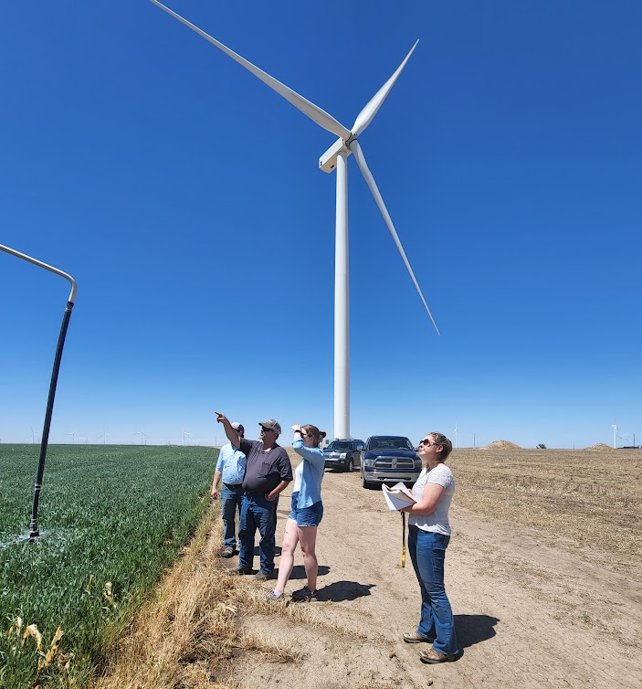
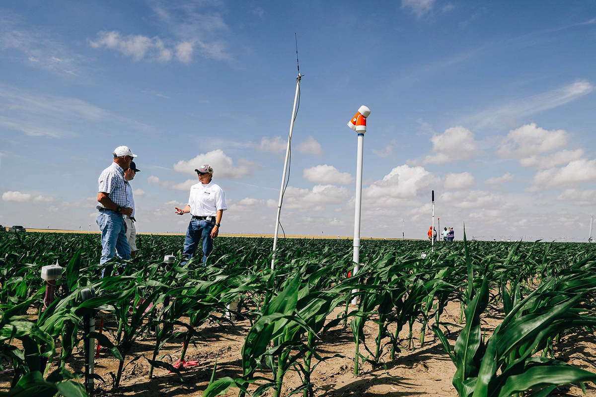
Having control also might provide some motivation to stick to water reduction targets. Groundwater management workers say that farmers are competing with one another to see who can grow the most with the least amount of water. To that end, there’s also been “an absolute explosion of new technology” during the LEMA years, Durham says. Rather than blindly irrigating crops, farmers have started using technology that tracks soil moisture and crop stress to know exactly how much water their plants need. If rain is on the horizon, they may choose not to pump.
Steiner says that some farmers are also opting to plant sorghum and other plants that need less water than corn. Pumping wells is expensive, which could also explain the higher profit margin for farms within LEMA boundaries. Farmers who are growing crops that require less water and are keeping an eye out for rain might be spending less money overall on irrigation, Steiner argues.
Stabilization: is it on the horizon?
Yet the question remains: are LEMAs helping to stabilize the Ogallala?
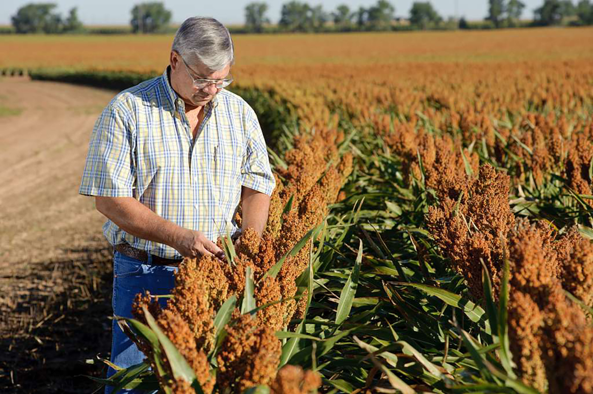
“It certainly is in my district,” Kenyon says. Indeed, at a recent Kansas state legislative session, Kalbas, the state geologist, presented data suggesting that the Sheridan-6 LEMA has extended the lifetime of the local water table by a factor of two. However, the aquifer is still being depleted faster than it can be replenished. As it stands, most LEMAs will need to undergo further reductions in the range of 0.5 to 2 ft per acre on average before they can achieve aquifer stabilization, Kalbas says.
Pumping has slowed down in the High Plains compared with its peak use in the 1970s. However, cutting down even further on groundwater use might be a tall order considering that climate change is moving the 100th meridian further east. Many parts of the central U.S. are expected to experience longer droughts and hotter summers—all of which add up to a greater reliance on groundwater.

Water reduction also depends on more areas adopting groundwater reduction programs like LEMAs. Some parts of western Kansas are highly motivated to preserve groundwater because agriculture is linked to the survival of the local community. But other parts of the High Plains, such as southern Kansas, have more industrial-scale agriculture and might be less interested in adopting groundwater conservation measures, Kenyon says.
Then there’s the question of whether other parts of the High Plains can even adopt a LEMA-like model since LEMAs work under the theory that “the best way to conserve water is through voluntary restrictions,” Kalbas says. In Kansas, water ultimately belongs to the state and is allocated to users through water rights. That allows for the creation of LEMA-like laws. States like Colorado that have similar legal structures around water might be able to follow Kansas’s lead.
But in other arid states, water belongs to individual property owners, which can make the creation of LEMA-like programs challenging. For these areas, state-sponsored programs like IGUCAS might be the preferred method for implementing water conservation.
For water conservation in the Plains, LEMAs are one important tool in the toolbox, says Kalbas. Solutions to groundwater depletion remain an active issue in the Kansas legislature. The house recently passed House Bill 2302—a proposal that would expand the budget for water planning by $7.3 million. Meanwhile, every groundwater management district in the state is required to evaluate its water supply and suggest solutions by next year.
These are encouraging signs to Kalbas. “We’re not ubiquitously seeing stabilization of the aquifer, but I think the data, the science, and the will are there,” he says.
Steiner has certainly witnessed more recent optimism towards aquifer stabilization than when she first started. “There’s just this sense that we don’t have to take this inevitable road to depletion,” she says. “We can try to take control of the future and sustain future generations.”
That is the end goal for people like Oelke. When he’s not growing corn and wheat on his farm, Oelke collaborates with Groundwater Management District 4 to create a plan for the next five-year LEMA to be renewed in Sheridan County in 2028. The mission is deeply personal.
“Right now, there is enough water in the Ogallala aquifer for me to have my career,” he says. For Oelke and so many others in his community, the impetus for adopting a LEMA “was never for the people in the room. It was always for the next generation—my kids, my grandkids, and my great-grandkids—to have the same opportunities that I did when I started farming.”
Dig deeper
View Jean Steiner's presentation at CANVAS 2024, "A Way Forward for the People of the Ogallala Aquifer Region?"
Text © . The authors. CC BY-NC-ND 4.0. Except where otherwise noted, images are subject to copyright. Any reuse without express permission from the copyright owner is prohibited.


