Better Accounting Needed to Solve Looming Groundwater Crisis

Across the U.S., we are withdrawing water far faster than our aquifers are naturally replenished. One of the challenges of determining how much water is left in aquifers is that decline rates are extremely variable over space and time and regulations governing groundwater withdrawal are highly localized. Over the long term, pumping water out of the ground faster than it’s replenished is like deficit spending; it will catch up with you. Earn 1 CEU in Soil & Water Management by reading this article and taking the quiz at https://web.sciencesocieties.org/Learning‐Center/Courses.
Last year, 2,031 wells ran dry in California. That is double the number that ran dry in 2021, which also set a record. Some 62% of the state’s thousands of monitoring wells were “well below normal” with 21% at all‐time lows in 2021. As the La Niña weather pattern sticks around another year, California expects to see more record drought. Texas too. Much of the state is under severe drought conditions. Meanwhile, a 2021 report out of Texas State University showed the state as a whole is losing groundwater “at nearly twice the maximum sustainable rate.” And groundwater is being pumped out of the nation’s largest aquifer, the High Plains/Ogallala, in Texas at 6.5 times faster than the maximum sustainable rate. Some parts of the aquifer have less than a 50‐year supply of water left.
Wells in Kansas, Oklahoma, Colorado, and elsewhere across the Plains are also running dry. Many others are dropping tens of feet every year. Farmers have had to drill deeper—at significant cost.
Scientists are trying to determine how fast water is being used and how much is left. They’re relying on everything from on‐the‐ground well measurements to satellite data showing soil moisture levels, subsidence levels, and water levels. Farmers, crop advisers, and government agencies are turning into de facto conservationists and are working together to determine best practices for saving water. It’s all hands on deck. And maybe, just maybe, we’ll be able to save enough water to keep farming for generations to come.
Underground Water Banks
About 2.6 million cubic miles of fresh groundwater exists beneath the U.S. in underground pools and layers of rocks called aquifers. But not all of that is accessible; some is too deep to technically or economically access. Aquifers also hold another 3.1 million cubic miles of salty or brackish water. But brackish water is unusable unless desalinated.
Aquifers are belowground layers composed of sand, silt, gravel, clay, or bedrock with water percolating among the layers and among the pore spaces in the sediments. Aquifers can be confined, meaning impermeable layers on top and bottom block water from moving. Once drilled into, pressure pushes the water upward through the well.
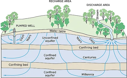
Or aquifers can be unconfined, meaning they don’t have impermeable layers blocking the water from percolating upward or downward. The top of unconfined aquifers is known as the water table. Unconfined aquifers are also connected to surface water and exposed to the atmosphere. Unconfined aquifers are replenished, and the water table moves up as water is added to the aquifer through rainfall, snowmelt, or irrigation; they are depleted, and the water table moves down as humans withdraw water from the aquifer or when drought strikes and evaporation increases. A well drilled into an unconfined aquifer requires a pump to bring the water up to the surface.
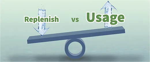
Across the U.S., we are withdrawing water far faster than our aquifers are naturally replenished. The United States Geological Survey (USGS) compares the water stored in the ground to the money kept in a bank account. “If you withdraw money at a faster rate than you deposit new money, you will eventually start having account supply problems.” Over the long term, pumping water out of the ground faster than it’s replenished is like deficit spending; it will catch up with you.
Groundwater Deficit Spending
The consequences of groundwater depletion include everything from increased pumping costs as water levels decline to wells drying up completely, from reduction of water in surface streams and lakes, to reduction of well water quality as more brackish water and heavy minerals creep in, to subsidence—sinking land.
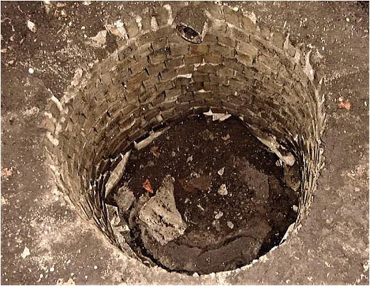
In Tampa, subsidence from groundwater withdrawal has caused dangerous sinkholes to open up. In Houston, land has dropped 10 ft in recent decades; that subsidence contributed to the devastating flooding wrought by Hurricane Harvey in 2017. In the San Joaquin Valley and parts of the Sacramento Valley, land is sinking almost a foot a year.
Declining water levels are perhaps even more concerning for farmers though. The lower the water level, the deeper a well has to be drilled—and that can add significant cost given that installing agricultural wells tend to cost about $85 to $105 per foot. In California, some wells in the Tulare Basin have been drilled to 3,500 ft to find adequate water, according to a 2022 paper in Nature. “The thing you have to remember is … we’re pumping water that’s 7,000 to 8,000 years old in many cases. As soon as the water’s gone, we don’t have another ice age to reestablish it,” noted Thomas Maddock, emeritus professor of Hydrology and Atmospheric Sciences at the University of Arizona in a 2021 report.
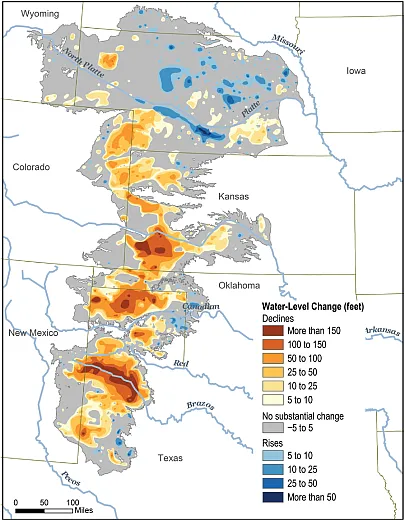
The High Plains aquifer, also known as the Ogallala Aquifer, has seen an average decline of 100 ft though it’s far higher in some places. Parts of the aquifer in Texas, for example, have experienced drops of 18 ft in just a few years.
Parts of Texas are also seeing intrusion of brackish water as they’ve drilled deeper to reach falling water levels. Miami, Long Island, and Savannah and other locations are seeing intrusions of seawater due to overpumping as well. Saltwater isn’t even the worst of what can be dredged up with drilling deeper: Arsenic, hexavalent chromium, and other heavy metals are also cropping up. As the water levels go down, water seems to become more concentrated, so you see higher total dissolved solid levels and increased pH, says Billy Barron, field technician supervisor with the High Plains Water Conservation District No. 1 (HPWD) in Lubbock, TX.
High Plains Aquifer Overdrawn
The High Plains aquifer underlies about 174,000 mi2 of prime farming real estate in eight states: Colorado, Kansas, Nebraska, New Mexico, Oklahoma, South Dakota, Texas, and Wyoming. Much of these states’ economies are based on agriculture and agriculture‐related businesses, which depend on the aquifer. Many of the region’s rural citizens also depend on the aquifer for sustenance. All told, the High Plains aquifer supports nearly a third of all U.S. crops and livestock, including about a fifth of U.S. wheat, corn, cotton, and cattle production.
The entire region is considered arid with annual rainfall ranging from about 15 to 23 inches and high evaporation rates especially in the summer. Groundwater‐level declines have been observed throughout the aquifer since irrigation became popular in the 1950s, according to a 2022 USGS report.
The aquifer is largely unconfined, so wells require pumps to bring water to the surface. It ranges in thickness from less than 50 ft to 800 ft. But the average freshwater saturated thickness—the distance between the water table and the base of the aquifer—is just 95 ft.
“In the High Plains, we’re definitely seeing problems with water depletion,” Barron says. “It’s getting more and more limited; we have to find new and better ways of using water.”
Eight States, Dozens of Districts, Same Bank
One of the challenges of determining how much water is left in the High Plains aquifer (or any aquifer) is that decline rates are extremely variable over space and time, says Shannon Kenyon, a geoscientist and executive director of the Groundwater Management District No. 4 in Kansas. Plus, she says, water moves so slowly through this portion of the aquifer that problems associated with declining water levels are highly localized.
Another challenge is that regulations governing groundwater withdrawal are also highly localized, says Karina Schoengold, an agricultural economist at the University of Nebraska–Lincoln. For example, Nebraska has a network of 23 natural resources districts that manage groundwater and soil. Kansas has five large groundwater management districts, and Texas has 98 water conservation districts. Every single one of these districts operates individually, which means “there’s no consistent way of regulating groundwater,” Schoengold says.
Some districts, like Kenyon’s in Kansas, halted new appropriations. “The state cannot issue any new water rights within our district,” Kenyon says. So if someone wants to develop a new farm or break a larger one up, the new buyers would have no automatic water rights. They would have to buy water rights from someone else. Other districts put moratoriums on any new irrigated acres, Schoengold notes. Still other districts offer farmers three‐ to five‐year allotments of water and let them choose how much to use each year. Barron saw an intriguing situation in 2022 related to such an allotment: When it became clear that the drought in Texas was going to be exceptional, farmers reacted a lot quicker than the last exceptional drought in 2011. That year, people kept trying to irrigate and save their crops, losing a lot of money in the meantime, whereas this year, he says, people “backed away earlier,” abandoning or plowing under their crops or selling livestock so as not to set themselves back for years to come.
Because regulations vary geographically, crop advisers need to be aware of water regulations for wherever they advise, Schoengold says. Search online for the local water conservation or management district and contact them. These groups have so much valuable information, Barron says. Farmers or CCAs just have to call. For example, if a farmer needs additional irrigation for a crop but there’s none allocated or none remaining in an allocation, the adviser needs to know that before advising the farmer. “The producers are stuck between a rock and a hard place,” Kenyon says. She’s heard too many stories of farmers being advised to add more and more water to their crops when there’s no more to give. And, in fact, if farmers were to overpump, they could lose their water rights. “The data show that we just don’t need to be putting as much water on these crops as historically thought,” she says.
How Can We Balance Our Groundwater Account?
The younger generation of farmers is “very concerned” about water and “very proactive,” Kenyon says. Her team is collaborating with many such farmers on water conservation technologies like soil moisture probes, variable‐rate irrigation, autonomous pivots, “and anything to really get the best bang for every drop that goes on that field, anything to make that producer profitable but also extend the life of the aquifer,” she says.
Barron says that farmers have recognized declining water levels in Texas’s HPWD for a couple of generations. “Our area has some of the most proactive people, learning how to grow things with the very least water possible,” he says. Farmers are creative, he says, putting in place crop rotations before that was widely accepted or growing crops like rye or wheat during a dry year—a crop they won’t make much money from but will promote the growth of cotton the following year, leading to more lucrative production.
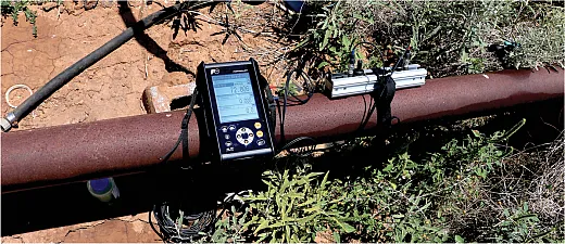
The HPWD and other such districts provide grants and assistance for water conservation technologies. They also provide well flow tests, water‐level measurements, and a detailed irrigation assessment program. In that program, HPWD staff assess water levels in wells at the beginning and end of growing seasons, as well as flow rates throughout the season, and then analyze total pumping hours, gallons per minute pumped, and the total number of irrigated acres to figure out the total acre‐inches of groundwater a farmer applied during the previous growing season. “At the end of the year, you can see how much water you actually used … and how much more water is available,” Barron says. By comparing their usage year after year, farmers can see if their production is what they think it is. Frequently, he says, farmers find out they’re not putting out nearly the amount of water they think, or they might be putting out far too much. “This is a big benefit we offer,” free of charge.
Though USGS does much of the groundwater monitoring throughout the states through annual measurements of depths to the water surface in designated monitoring wells. State geological surveys also have thousands of wells they monitor annually. Many of these local water districts also do inspections both on designated monitoring wells as well as on private wells. Thus, crop advisers should check with local water districts to see what water services they offer.
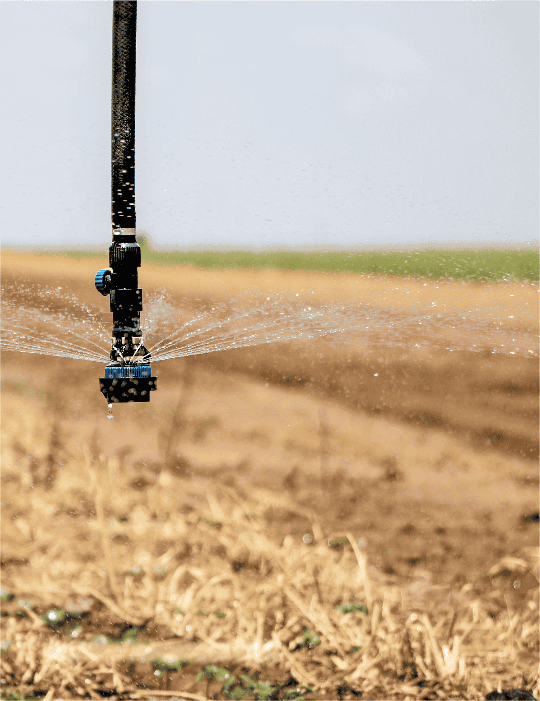
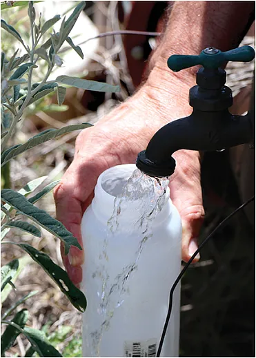
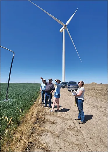
Organizations like the High Plains Underground Water Conservation District (HPWD) in Texas collect data on water quantity and quality in the High Plains Aquifer each year. Photo courtesy of HPWD. Staff at the Groundwater Management District 4 (GMD 4) in Kansas routinely visit with growers to work on groundwater monitoring and irrigation issues to reduce the pull on the Ogallala Aquifer. Photo courtesy of GMD 4. Center pivot irrigation systems can efficiently water fields, allowing farmers more control over when and how much water they apply, thus using less water overall. Organizations like the High Plains Underground Water Conservation District (HPWD) in Texas often recommend such systems to conserve water. Photo courtesy of HPWD.
Yet another option, offered by the USDA‐NRCS Conservation Reserve Enhancement Program in targeted locations, is selling your water rights and retiring your field. Say a farmer has a portion of their land that’s not very productive, Schoengold says. They could put it into an easement or permanent dryland, sell the water rights, and then focus on other land that has higher productivity. Crop advisers can contact NRCS for more information. Some state or regional programs will also buy water rights. For example, the Platte River Recovery Implementation Program, which operates in Nebraska, has purchased rights to manage water in the Platte River. Certified Crop Advisers can facilitate connections for a farmer who might be interested in selling their water rights.
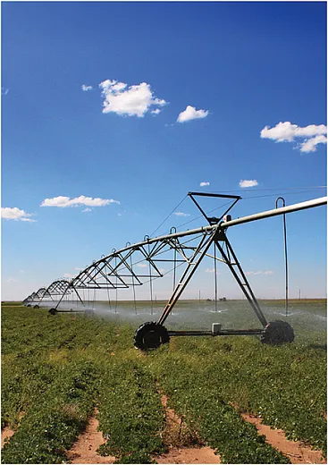
they apply, thus using less water overall. Organizations like the High Plains Under- ground Water Conservation District (HPWD)in Texas often recommend such systems to conserve water. Photo courtesy of HPWD.
Schoengold says CCAs can also facilitate farmers getting involved with research that may help them make better financial decisions. For example, the Testing Ag Performance Solutions programs at the University of Nebraska and Oklahoma State University have been set up to let farmers test different approaches for managing their land in a lower‐risk way. “People try out different strategies, like ‘what if I cut my water use by 20%?’ And then they try it on the university land first and maybe realize ‘oh the impacts are very low,’” so they can go try it at home, armed with less risk and more knowledge, she says. This is one of the results of the Ogallala Water Coordinated Agriculture Project (CAP), a five‐year USDA‐funded multidisciplinary, multistate research and outreach program. Other results include a “hydroeconomic modeling framework that can integrate the hydrology of an area with expected economic decision‐making along with surface water and soil information to determine the impacts of making various changes in water management,” Schoengold says. (For more information on the CAP program, visit https://ogallalawater.org/.)
Banks are also starting to take notice of declining water in the High Plains and elsewhere, Schoengold notes. We’re starting to see changes in crop insurance, including a new tool called deficit irrigation insurance, so that’s something CCAs could look into.
What’s important for the future of this vital region, Schoengold says, is to have some “coordination of knowledge—being aware of what might work in one place, so that knowledge can be applied somewhere else.”
The High Plains aquifer has been declining for a very, very long time, Kenyon says. But it’s getting worse. It’s overappropriated and overpumped, and with droughts like much of the region has seen over the last 20 years, we’re only likely to rely on it—and other major groundwater sources—more often.
Self-Study CEU Quiz
Earn 1 CEU in Soil & Water Management by taking the quiz for the article at https://web.sciencesocieties.org/Learning-Center/Courses. For your convenience, the quiz is printed below. The CEU can be purchased individually, or you can access as part of your Online Classroom Subscription.
- Groundwater is being pumped out of the High Plains/Ogallala Aquifer in Texas at what rate?
- Five times faster than the maximum sustainable rate.
- Three and a half times faster than the maximum sustainable rate.
- Six and a half times faster than the maximum sustainable rate.
- Eight and a half times faster than the maximum sustainable rate.
- In California, what percentage of monitoring wells were well below normal in 2021?
- 44%.
- 62%.
- 73%.
- 80%.
- Which of the following is a consequence of groundwater subsidence?
- Formation of sinkholes.
- Increased vulnerability to flooding.
- A need to drill deeper wells.
- All of the above.
- The water level of the Ogallala Aquifer has declined an average of 50 ft.
- True.
- False.
- Declining water levels often mean decreased water quality. Which of the following impacts is NOT mentioned in the story?
- Brackish water.
- Increased levels of heavy metals.
- Lower dissolved oxygen levels.
- Increased pH.
- The High Plains aquifer is critical to agriculture in eight states. Which of the following states is NOT included in that area?
- Arizona.
- Kansas.
- South Dakota.
- Wyoming.
- Which of the following is NOT a type of aquifer?
- Confined.
- Unconfined.
- Ephemeral.
- All of the above are types of aquifers.
- Aquifer decline rates are extremely variable over space and time, and regulations governing groundwater withdrawal are highly localized.
- True.
- False.
- Numerous resources and programs are available to farmers who need help with water issues. For example, farmers can sell water rights on land that’s not productive. Which of the following organizations offers this program?
- Land-grant universities.
- USDA-NRCS.
- Local water management districts.
- USGS.
- Some farmers may be able to partner with nearby universities to test water conservation strategies before committing to them on their own land. Which university was mentioned in this article as currently offering this opportunity?
- The University of Wisconsin–Madison.
- Texas A&M University.
- Ohio State University.
- None of the above.
Text © . The authors. CC BY-NC-ND 4.0. Except where otherwise noted, images are subject to copyright. Any reuse without express permission from the copyright owner is prohibited.


