Carbon Dynamics in Wet Soils of the Outer Coastal Plain
Carbon Dynamics in Wet Soils of the Outer Coastal Plain By Martin Rabenhorst, Jocelyn Wardrup, and Maxine Levin, University of Maryland On 3–5 November, 26 participants joined with seven additional organizers and support personnel for the SSSA Soil Geomorphology–Pedology Field Tour, which followed the theme “Carbon Dynamics in Wet Soils of the Outer Coastal Plain.” The group included a variety of graduate students, academics, consulting professional soil scientists and government staff from across the country and world. While the focus of the trip was to explore carbon dynamics in coastal plain soil landscapes and wetlands, the event provided a grand opportunity for networking and sharing field techniques, observations, and perspectives.
During the tour, participants visited sites in tidal marsh and dune landscapes across the Eastern Shore of Maryland. The tour began with a pre-meeting orientation and “meet and greet” Thursday evening. Then early Friday morning, the group departed amidst thick fog and unseasonably warm temperatures to begin the trip crossing Chesapeake Bay. Four of the six sites visited showcased tidal marsh soils of distinctive pedogeomorphic units (PGUs) that had been investigated by recent University of Maryland (UMD) M.S. graduate Jordan Kim. The two other sites visited on Saturday focused on Holocene dune-interdune landscapes on Assateague Island, featuring work by former UMD Ph.D. student (2014) Annie Rossi-Gill, and then back on the mainland, late Pleistocene dunal landscapes, investigated by former UMD M.S. (1991) student Margaret Condron.
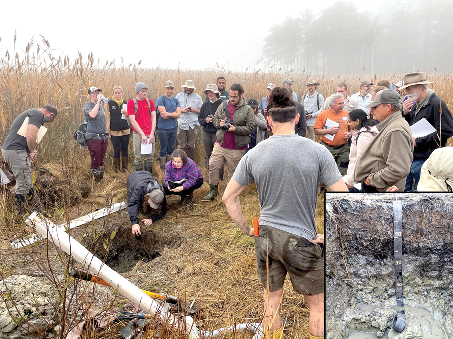
The first stop of the tour was to view a submerged upland PGU marsh at the Chesapeake Environmental Center (Figure 1). These soil landscapes have been impacted by sea level rise, and as a result, have O horizons that increase in depth towards open water. The O horizons store nearly all of the carbon in these systems. The soil observed was an Endoaqualf (similar to Sunken and Honga series) with an argillic horizon reflecting its past unsaturated conditions and a histic epipedon resulting from the conversion to tidal wetlands. These soils shift from Ultisols to Alfisols due to increased base cations from seawater. Sulfide minerals also commonly form following reduction of sulfate from tidal waters of Chesapeake Bay. Participants observed a rarely excavated soil test pit in tidal wetlands and observed a nearby ghost forest (dying trees at the upland boundary from sea level rise).
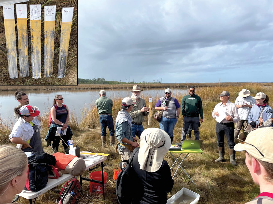
The second stop was at the Shorters Wharf Marsh, an estuarine brackish marsh (estuarine non-fresh PGU) in the Blackwater National Wildlife Refuge. Tour participants had the opportunity to use a Macaulay sampler, an excellent method for extracting marsh cores and preserving bulk density (needed to calculate carbon stocks). A 300-cm core was laid out for all to see the thick (118 cm) organic surface lying over moderately to highly fluid mineral materials. Jordan Kim demonstrated determination of rubbed fiber for degree of organic decomposition and discussed the Von Post method. A new method for determining porewater sulfide content in tidal wetlands using IRIS (Indicator of Reduction in Soils) technology was showcased (Figure 2). For more information, see the recording of Dr. Martin Rabenhorst’s oral presentation at the 2022 Annual Meeting (https://bit.ly/3Inslgo).
At lunch on Friday, participants visited the recently opened Harriet Tubman Underground Railroad National Historic Park (Museum), which featured the life and exploits of this intrepid “conductor” on the Underground Railroad, who during 13 trips, led some 70 enslaved people to freedom between 1849 and 1860. Tubman’s birthplace is located nearby in Bucktown, MD.
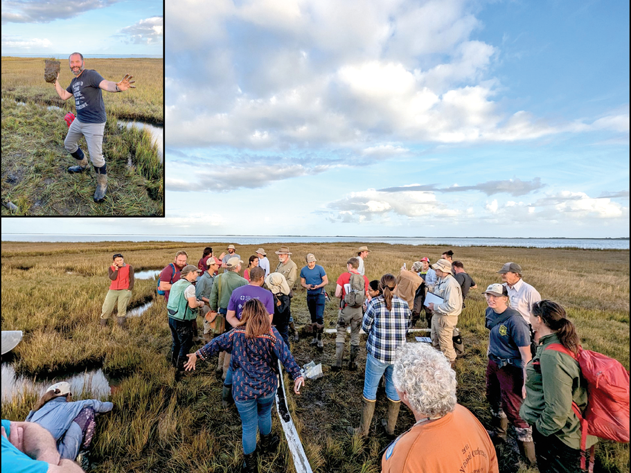
The last stop of the first day was in Assateague State Park on the west (mainland) side of Sinepuxent Bay where we examined the soils of a coastal mainland PGU marsh (Figure 3). The soils of these areas are shallower and may have buried organic horizons as observed by participants. A demonstration used a few drops of HCl added to a small amount of soil in a zip lock bag (the modified whiff test) for assessing the presence of acid volatile sulfides if a “rotten egg” odor is detected. For more information regarding carbon stocks in Mid-Atlantic tidal marshes, please view Jordan Kim’s recorded oral presentation from the 2022 Annual Meeting (https://bit.ly/3ZcsVUa).
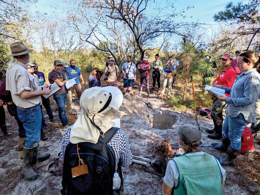
That evening, the group enjoyed experiencing the coastal tourist destination and boardwalk of Ocean City, MD. On Saturday morning, participants headed off toward Assateague Island National Seashore to view the last of our tidal marsh PGUs in the coastal barrier setting. Then, just a bit further south on Assateague Island, the group viewed a short topohydro-sequence in recent Holocene overwash deposits to illustrate both carbon dynamics in these young dunal landscapes and “difficult to interpret” hydric soils. Dr. Annie Rossi-Gill led a discussion of hydric soil field indicators developed for these soils (Figure 4).
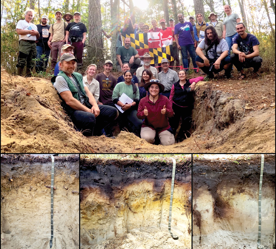
Following lunch along the Pocomoke River in the small eastern shore town of Snow Hill, the group visited the final stop of the trip in the Pocomoke State Forest. Three pits were open for the group to examine some spectacular Aquods along a topohydro-sequence in late Pleistocene dunal deposits (Evesboro, Atsion, and Berryland series) (Figure 5). Participants had the opportunity to observe hydric soil field indicator S7 (dark surface).
Text © . The authors. CC BY-NC-ND 4.0. Except where otherwise noted, images are subject to copyright. Any reuse without express permission from the copyright owner is prohibited.